 |
|||||||||||||||||||||||||||||||||||||||||||||
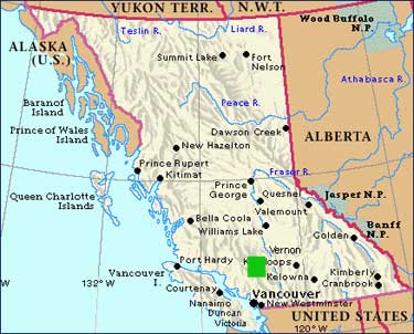
| Map of BC with area of detail highlighted in green box | Area of Detail | ||||||||||||||||||||||||||||||||||||||||||||
 |
 |
||||||||||||||||||||||||||||||||||||||||||||
| You can see Lillooet at the bottom of the map at right, Pavillion a little further north, and the gravel mountain road connecting Pavillion with Kelly Lake.
The route we cycled follows the blue dotted line. |
|||||||||||||||||||||||||||||||||||||||||||||
| Where: See above
Who: Reimar, cousin Cary from Bellingham, Ed, Andre & myself June 4 We piled the three bikes, tandem, all our gear and ourselves into Reimar's VW Transporter (suitably named) and drove about six hours to Kelly Lake. I think we were the only ones at the campsite, and it was windy and cold there as usual. |
|||||||||||||||||||||||||||||||||||||||||||||
 |
|||||||||||||||||||||||||||||||||||||||||||||
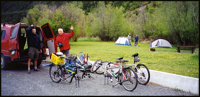
| At Kelly Lake's Downing Prov. Pk. Campsite. L-R: Cary, Reimar, Ed, Trudel | |||||||||||||||||||||||||||||||||||||||||||||
| June 5
Andre and I woke up about 6:00 and seeing as how no one else was stirring we quickly got dressed and did a "morning run" on the tandem into Clinton - 17 km's away. But the road is pretty flat (by BC standards) and it's paved. By the time we were back the others we just getting up. By 9am we were all geared up and ready to go. We left the van at the campsite, cycled the 100 yards of pavement between the campsite and the junction to Jesmond, then hit the gravel and the long hill. |
|||||||||||||||||||||||||||||||||||||||||||||
 |
|||||||||||||||||||||||||||||||||||||||||||||
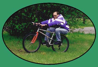
| Ed shows us how a real man rides his bike. | |||||||||||||||||||||||||||||||||||||||||||||
| Bears Galore At the top of the hill where the road splits we pulled aside for some bike maintenance to both Reimar and Ed's bikes. No further than 75 yards away did I spot not one, but two, large black bears grazing. Before I actually looked up, out of the corner of my eyes I assumed the large black and brown shapes were just cows. But when I realized what they were I quickly grabbed Reimar's arm and pointed them out. Uninterested in us, they grazed their way back into the woods after a few minutes.
Bikes fixed, we continued. It became an enjoyable, fast ride along the winding mountain road and occasionally we'd pass by a ranch here and there: the Circle H Mountain Lodge, signs for Echo Valley, etc. Andre and I raced ahead on the speedy tandem and before we knew it had raced by a mother bear and her two cubs right below us where the edge of a field met the ditch of the road! That's five bears in about 20 minutes! And that's not all! We came around a corner and squat in the middle of a huge field was a grizzly bear the size of a VW Beetle! No kidding - that brute was HUGE! We stopped and waited for the others to come around the corner and as they did their noise caught his attention and he bolted. We were far enough away, with a good fence between us too, that if he'd charged we could have sped off downhill quite quickly. Now that was six bears in a half hour - a definite record for us! |
|||||||||||||||||||||||||||||||||||||||||||||
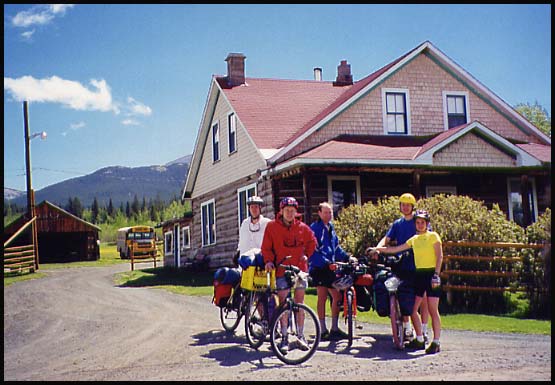
| Jesmond By the time we came down the hill into Jesmond, the sun was out and the sky was blue. It made for a great spot for a snack and a photo before we embarked on the 25 km descent to the Fraser River and High Bar Road.
For another look at Jesmond, click here to see a photo I took while passing through in '94. |
|||||||||||||||||||||||||||||||||||||||||||||
 |
|||||||||||||||||||||||||||||||||||||||||||||
| Group photo at Jesmond. L-R: Cary, Reimar, Ed, Andre, Trudel | |||||||||||||||||||||||||||||||||||||||||||||
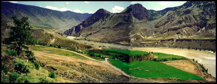
| Down, down, down the hill we sped until finally we came around a corner and the landscape opened up before us to reveal a land more like Arizona or Baja than BC. The Fraser River, some ranch lands and the thin thread of the narrow, twisting High Bar Road all lay among the textured, sage covered hills. | |||||||||||||||||||||||||||||||||||||||||||||
 |
|||||||||||||||||||||||||||||||||||||||||||||
| Here is a rather poorly spliced image of the High Bar Road area and the always-silty Fraser River. | |||||||||||||||||||||||||||||||||||||||||||||
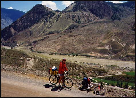
| The sun blazed down on us and nowhere was there a speck of shade to shelter for lunch. We came to a convenient pull-out with a great view that did have "a" tree, but somehow it just didn't cut it. Seeing as how there was no shade for miles, we made use of the scenic spot for lunch and resigned ourselves to the blistering heat. | |||||||||||||||||||||||||||||||||||||||||||||
 |
|||||||||||||||||||||||||||||||||||||||||||||
| Reimar wearing his Gore-Tex as sun protection poses above the brown waters of "The Mighty Fraser". | |||||||||||||||||||||||||||||||||||||||||||||
 |
|||||||||||||||||||||||||||||||||||||||||||||
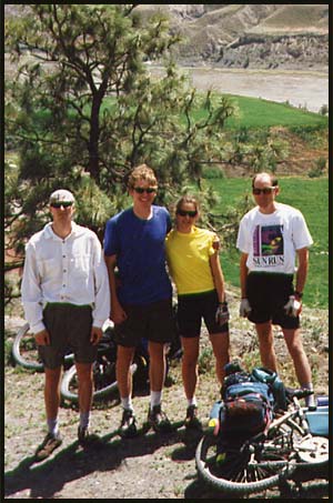
| Cary, Andre, me & Ed stand before the only tree in sight. BTW, nice posture there, Cary and Ed! | |||||||||||||||||||||||||||||||||||||||||||||
| After a lengthy lunch we rolled our way down the last turn in the road, crossed a tiny bridge below the ranch house and pushed the bikes up and up and up. The road is narrow and dusty and just carves itself along the mini-canyons. Where the crow might fly one kilometer, the road easily travels five.
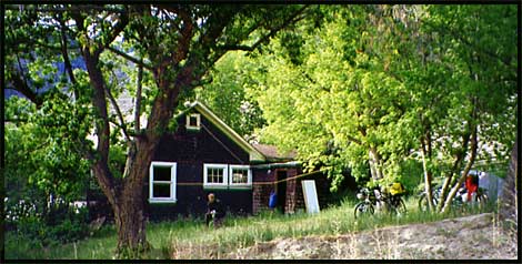
Not the easiest road to ride (mainly because of the heat), but definitely one of the most scenic, we made our way along stopping frequently to take in the expansive views. Water was an issue, and we definitely needed to find a good source. We were sure there would be a creek coming down from the mountains and sure enough we came upon a tiny one. It flowed through a small gorge near a vacant ranch house which sat surrounded in lush greed trees and green grass. Seeing how it was abandoned, we decided it made sense to camp here, even though it was only about 3:00. Where else would we get shade and water? |
|||||||||||||||||||||||||||||||||||||||||||||
 |
|||||||||||||||||||||||||||||||||||||||||||||
| The vacant ranch hose where we set up camp under the lush green trees. Our bikes sit propped on the right and Andre is barely visible below the middle window of the house. | |||||||||||||||||||||||||||||||||||||||||||||
| With camp set up we found ourselves with the rest of the afternoon to explore the area. We checked out the old barn, took a very brief peek inside the house (full of mouse poop), and walked the flat, sloping plateau to its edge high above the Fraser.
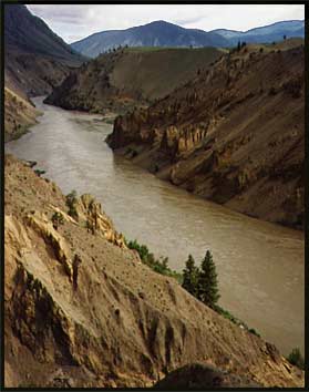
Looking down at the river and across to the virtually untouched lands, it wasn't hard to imagine Simon Fraser and his crew floating down these very waters hundreds of years ago. Begin northern Europeans, I wonder what they thought of this barren, brown landscape? |
|||||||||||||||||||||||||||||||||||||||||||||
 |
|||||||||||||||||||||||||||||||||||||||||||||
| The Mighty Fraser | |||||||||||||||||||||||||||||||||||||||||||||
| June 6
Stunned and sleep-deprived, we stumbled out of the tents this morning and went about our morning activities in a daze. At around midnight a stiff wind began blowing, and just blew harder and harder. The sides of the tents were being picked up, so much so that I was even being lifted off my mat. The tent walls rattled, shook and flapped violently. I was worried that one of the large branches above us might snap and come down on us. The pegs pulled out of the ground, so Andre crawled out to gather some rocks to pin the edges down. Out in the dark he had a fright when he spotted a ghost! But no - ghosts don't wear underwear! It was his dad also collecting rocks for the tent he was sharing with Cary. And where was Ed during this storm? He was sound asleep in his bivy out in the middle of the field!! Even when sheets of rain came pouring down, there he stayed. What luck, to end up in one of the driest areas of the province the one evening it pours rain and storms. Oh well, it was a memorable experience. (And as we would find out in years to come, surprisingly quite typical for that area) |
|||||||||||||||||||||||||||||||||||||||||||||
 |
|||||||||||||||||||||||||||||||||||||||||||||
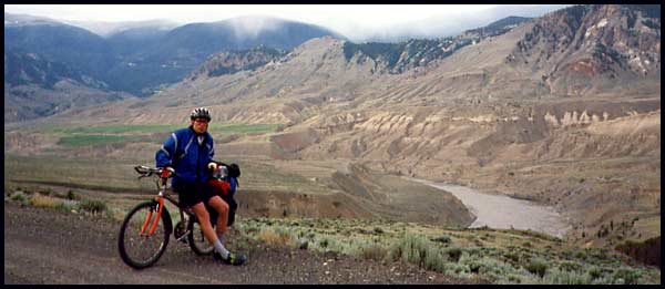
| Ed on a cool and overcast morning on High Bar Road. That's actually snow in the hills at top center. | |||||||||||||||||||||||||||||||||||||||||||||
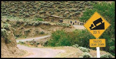
| Close to noon we were at the base of "the big hill". The flattish, winding road just comes to an end at a small log shed, makes a sharp turn and climbs straight up the mountain over the course of a dozen switchbacks or so. This pass is well known to locals far and wide and named "Cougar Point Pass".
It's a good solid two-hour push with the fully loaded bikes. |
|||||||||||||||||||||||||||||||||||||||||||||
 |
|||||||||||||||||||||||||||||||||||||||||||||
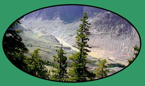
| But, the views are worth it.
Or that's what Andre and I think anyways. |
|||||||||||||||||||||||||||||||||||||||||||||
 |
|||||||||||||||||||||||||||||||||||||||||||||
| At the top of the steep hill the road turns and leads gradually uphill and inland away from the views and into Edge Hills Park. As we climbed the temperatures plummeted and eventually it began snowing on us. The final 15 minute downhill back to the car was painful on the bare skin and we were all thankful that the heat in this VW van actually works! | |||||||||||||||||||||||||||||||||||||||||||||
 |
|||||||||||||||||||||||||||||||||||||||||||||
| If you thought this scenery / trip was kinda cool, check out the High Bar '01 trip for another variety of scenic photos | |||||||||||||||||||||||||||||||||||||||||||||


